About Us
Why Geomatics you ask?
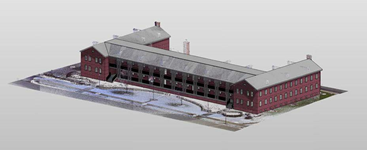
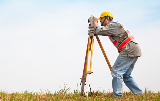
Over the past 30 years, the proliferation of three-dimensional positioning technologies has exploded. No longer are the determination of dimensions and contours of the earth’s surface restricted to the use of tripod-mounted land surveying tools such as theodolites, levels, or more modern total stations. Now surveyors routinely employ lasers, LiDAR, digital imagery, satellites, and inertial measurement units to capture and model 3D data. They do this well beyond the limits of traditional, local, plane project limits, such as a 10-acre project site and routinely work on a regional basis. These modern technologies, over larger areas have required land surveyors to think differently, apply different models to their data, and embrace principals from what used to be disparate fields.
The same could be said for the evolution of engineering over the past 30+ years. Now more than ever, we understand the value in designing with nature in mind, but it requires a multidisciplinary approach and environmental planning to do it right. Today, engineers routinely use 3D data to geo-reference what lies below, on and above the surface of the earth, including what exists inside and outside of buildings. Within the last decade, engineers are beginning to utilize the concept of geodesign as a process of designing certain aspects of the environment within the context of geographic space. In essence, today’s engineer combines GIS analysis with design.

To continue to label the processes regularly undertaken by surveyors as “land surveying” and by engineers as “engineering” misses the big picture. Surveying and engineering have collectively evolved; they have expanded in so many ways. As practiced today by progressive firms, surveying and engineering could be a combination of classic techniques, along with geodesign, remote sensing, close range photography, aerial imagery, mobile mapping, laser scanning, photogrammetry, and LiDAR; with this evolution comes the evolution of the name to reflect the current state of the art.

The term geomatics has gradually emerged and has been embraced by the surveying and engineering industry, particularly by progressive companies, which offer a wider range of services. Geomatics includes the traditional surveying and engineering definition along with the increased importance of new technologies and the growing demand for a variety of spatially related types of information, particularly in measuring, monitoring, and designing our environment.
Schneider Geomatics professionals help design, map, and manage the natural and the man-made resources of the earth. Their skills and efforts are important in project development and environmental protection. They gather, analyze, and manipulate data; map results; help design the built environment and then document the results. The disciplines used in geomatics are based on advancing technologies and use an integrated approach to the acquisition, analysis, storage, distribution, management, and application of spatially referenced data.
Looking for a career? Invest in your future.
We pride ourselves on being a home for the best and brightest engineers in the industry. We also know how important it is to take care of our own. That’s why we place such an emphasis on growth, promotion, and opportunity for our team members.
See what a career with Scheider could be.
